Touch the Misty Mountain of Ramkhamhaeng National Park
Dominant in its historical, archeological, and natural resources, Ramkhamheang National Park the incredible sightseeing in Sukhothai province which named after Ramkhamhaeng the Great, the notable king of the ancient Sukhothai Kingdom to honor his glory and fortunate to the place.
About the Place
Ramkhamhaeng National Park or better called locally is ‘Khao Luang’ is the natural property covers over the land within Mueang, Ban Dan Lan Hoi, and Khiri Mat district in Sukhothai province with approximately 213,215 rais or about 341.144 sq.km in total. The place recognized the first historical park that is very exciting regarding traveling and academic since the spectacular location is rich in historical resource dates back to the Sukhothai era along with the abundant natural property. The location was known as “Khao Luang Forest” in the past, later the government office preserved the land in preparation to proclaim it as the national forest. Also, it renamed to “Ramkhamhaeng” which is a propitious name from the title of the prodigy king of Siam “Pho Khun Ramkhamhaeng Maharaj” or King Ramkhamhaeng, the great king from Phra Ruang Dynasty in the Sukhothai Kingdom who created Thai alphabets. ‘Khao Luang’ which is the former name of the place is similar to “Khao Luang Forest” which is the title of Khao Luang National Park in Nakhon Si Thammarat.
Khao Luang Peak, the lofty mount stands elegantly in Ramkhamhaeng National Park where the place is the best spot to witness various species of the wildlife, for example, Banteng, Barking deer, Bear, Wild Boar, Alcedinidae, Swallow, etc. The crucial plants within the forest are including Teakwood, Iron Wood, Sharea obtuse, Ingrin, and herbs. Moreover, the beautiful waterfall and many caves rich in its historic property that is perfect for sightseeing and leisure. Ramkhamhaeng National Park was proclaimed officially to be the national park dated October 27, 1980.
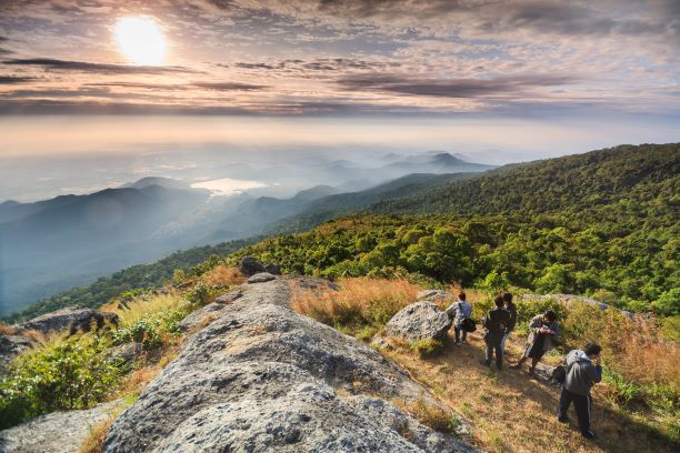
The typography and climate of Ramkhamhaeng National Park are complex mountains lie vertically from the north to the south over the plain looks like the gigantic anthill rises predominantly in the middle of the rice field. At the top of the mountain, it is cold all through the year, while the place is covered with the misty blanket in the winter and the rainy season. The temperature at Ramkhamhaeng National Park is between 12 – 14 degrees Celsius on average and the most pleasant time that you can relax with the climate here is between December to January. The best period to visit the national park is from September through February annually.
What to See at Ramkhamhaeng National Park
The interesting attractions within the fantastic Rakhamhaeng National Park that the tourists should not miss including;
1. Khao Luang
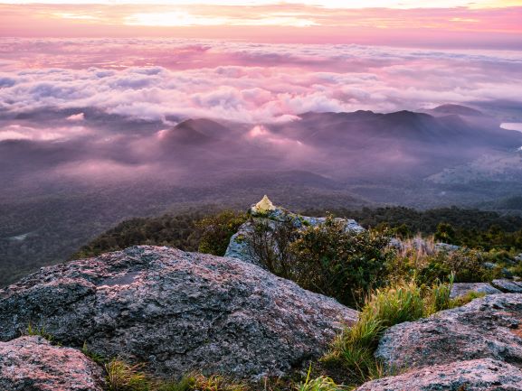
The famous mountain with approximately up to 1,200 meters above the sea level consists of the high cliffs, and the highest peak is in the south of the Sukhothai city. Upon the summit features the heart taking scenery covering with the vast natural meadow. Khao Luang is composed of 4 mountain tops namely;
- Narai Peak or also called “Pha Narai” (Narai Cliff) the prettiest location to witness the sunrise over the Khao Luang and in Sukhothai. A 1,160 meters high where is also the location of the telecommunication base of the Royal Thai Air Force with about 25 rais of space. Narai Peak presents the beautiful steep cliff ideal to be the place to spend your leisure time, surrounding with the stunning panorama and allowing you to see the glittering light from the town of Sukhothai and Phitsanulok at the nighttime.
- Phra Mae Ya Peak is 1,200 meters from the sea level. Formerly, the site was the pilgrimage base of Phra Mae Ya or Phra Nang Sueang, mother of King Ramkhamhaeng.
- Khao Phu Ga is also 1,200 meters high above the sea level, and
- Khao Phra Chedi where the peak is up to 1,185 meters from the sea level.
The spectacular scenery from all of these mountain peaks is so incredible and also allowing us to see the dam created since the ancient Sukhothai era with the title is “Saritphong Dam” or Phra Ruang Dam, as well as the city town of Sukhothai without any blockage.
2. The Meadow
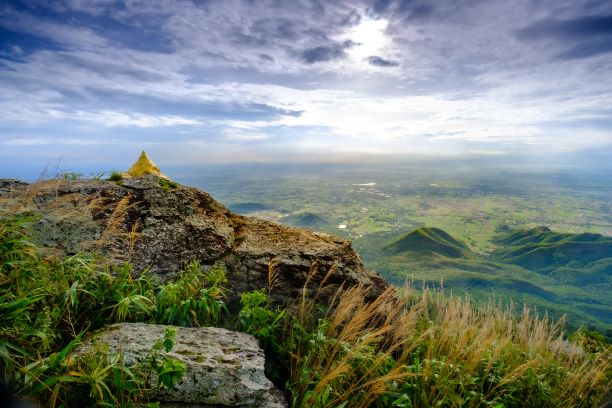
On the top of the mountain within Ramkhamhaeng National Park is the vast field which created by nature. The spacious meadow is approximately 3,000 rais or 4.8 sq.km features diverse species of the grass that some of them are herbal plants.
3. Sai Ngam (the Beautiful Banyan Tree)
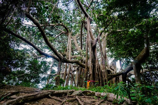
An amazing huge banyan tree with the beautiful branches sprawling to shelter for anyone who seeks for a relaxing spot to take a seat and enjoy the lovely circumstance of nature. The notable tree situated on the way to climb up to the peak of Khao Luang.
4. Plong Nang Nak (Lady Naga’s Chimney)
Nature made chimney is at the top of the hill which is about 320 meters away from the Banyan Tree. Plong Nang Nak is about 0.5 meters in its width and 1.5 meters in its height approximately, however, it’s uncountable for the depth. According to the local mythology ‘the Legend of Phra Ruang’ recorded in the Northern Chronicle mentioned to the pilgrimage of the ruler at Khao Luang, as a result, ‘the Legend of Phra Ruang’ which related to this chimney.
5. Herbs
Over the vast space of Ramkhamhaeng National Park is abundant with the diverse species of the herbal plants; Elephantopus scaber, Black Tulipwood, Cardwell lily, Schefflera leucantha, and Betula alnoides, for instance.
6. The Gate of History
There’s a historical gate called ‘Pa Gate’ in the north of Suan Lum or the area which is the base of National Park Preservation Unit. In the west is ‘Macha Gate’ as an entrance in the location of the fortress, while ‘Plue Gate’ is in the east of Suan Lum at the checking point of the national park. And in the south is ‘Phra Ruang Gate’ with the story mentioned that it was the place that Phra Ruang played the kite around this ground.
7. Suan Lum or Suan Lumpiniwan
The so-called botanic garden with lots of herbals plants located at the foothill of Khao Luang. Presently, it is the location of Ramkhamheang National Park Office where the place is in the east of Khao Luang.
8. The Buddha’s Footprint
The religious mark is at the foothill of Tham Phra Bat Hill. The footprint created from slate and graved with the 108 auspicious things pattern. It was made in the reign of Maha Thammaracha I or King Lithai of the Sukhothai Kingdom dated back for 600 years ago.
9. Prang Khao Pu Ja (Pu Ja Mount Stupa)
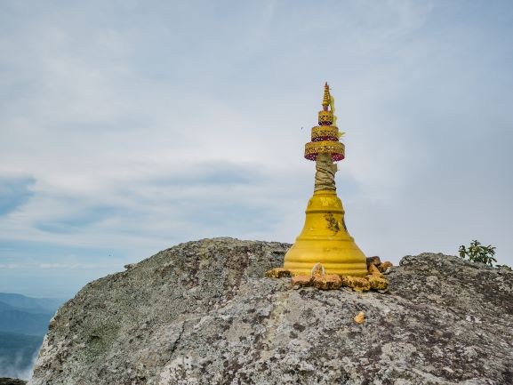
The prang style stupa made with the large block of bricks and stood over the low hill nearby Ramkhamhaeng National Park. The Khmer art pagoda is Baphuon influence that created as the religious place for the travelers to practice the religious rite or ceremony.
10. Tham Narai (Narai or Vishnu Cave)
Tham Naria is a place that discovered the religious image of Avalokitesvara with the radius; however, the locals misunderstood that it’s the statue of Vishnu, one of the great deities of Hindu. Unfortunately, the figure was destroyed, and only the pedestal remains.
11. Tham Phra Mae Ya (Phra Mae Ya Cave)
Tham Phra Mae Ya is a large rock shelter that used to be the location to enshrine the statue of Phra Mae Ya. Nowadays, the image relocated to enshrine at Phra Mae Ya Shrine at the City Hall of Sukhothai.
12. Phra Rung Road
A historical road that connects between Kamphaengphet passed over Sukhothai to Si Satchanalai with approximately 123 km in its distance. It presumed that the way was constructed in the last 700 years ago as the strategic route; also the path might be the first highway of Thailand.
13. Saritphong Dam and the sources of water in the old time
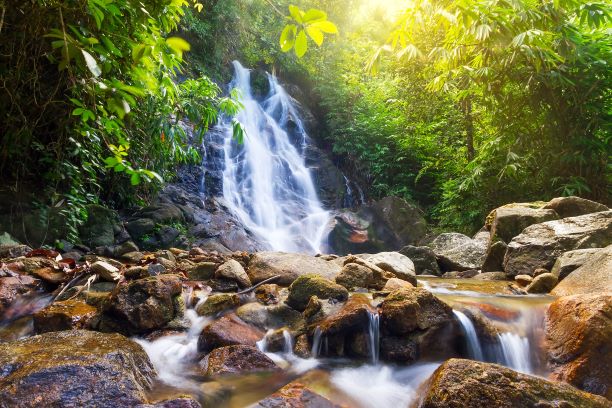
Saritphong Dam is the weir or dam in the ancient period which originally called “Phra Rung Dam.” The dam is a barrier to the water between Phra Bat Yai Mountain and Gew Ai Ma Mountain. In the ancient time, the water from the dam was supplied to the community and the royal residence inside the city wall via the canal to Traphang Ngern – Traphang Thong Pool. Presently, the structure has been under restoration by the Royal Irrigation Department. On the other side, the important sources of water in the past called “Sok” or stream included Sok Phra Rung Lub Phra Khan, Sok Phra Ruang Long Phra Khan, Sok Phama Fon Hok, Sok Chompoo. The King Rama VI of Rattanakosin Kingdom took the journey to visit the Phra Ruang Kingdom where lots of sources of water originated from Prathak Mountain.
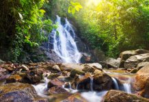
Besides those aforementioned, if you are someone who yearns for some natural splash, you must not miss visiting Namtok Sai Rung or the Rainbow Waterfall, Lam Klaew Waterfall, Hin Rang Waterfall, and Klong Khan Nai Reservoir.
Additionally, for the adventure lover, Ramkhamhaeng National Park also arranges the nature trail for the tourist to enjoy a bit of challenging trip. The trail starts from the national park office and passes the herb garden, dry evergreen forest, Sai Ngam (Banyan Tree), soil horizon, and stratum, for example, and destines at Hin Rang Waterfall. The journey is approximately 3 km with about 2 hours for the trip and worry-free to get lost as the park set up the signages to guide the direction along the way intermittently.
Tourist Information
The admission fee of Ramkhamhaeng National Park:
Thai: Adults is THB40, Children is THB20
Foreigners: Adults is THB200, Children is THB100
In case the tourist needs the porter for your belongings to ascend to the top of Khao Luang, it’s about THB10 per kg of charge that you can contact for the service at the national park office.
Remark: Once the tourist paid for the entrance, please keeps the ticket with you while you are traveling inside the park since the office will ask for the inspection.
The facility:
The national park provides visitors with full tourist facilities’ including accommodation, campground, restaurant, and tourist center. And the Ramkhamhaeng National Park opens all through the year.
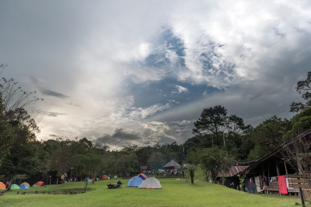
The accommodation provided by the national park is allocated into 3 units suitable for 6 – 10 people. The price starts at THB500 per night. And the tent for rental which is ideal for 2 – 8 people with the amount is THB5- – THB200 per night. In case the tourist brings along the camping facility and tent; the THB30 is charged for space. For any further queries, please contact the national park office.
Things to Know before taking a trip to Ramkhamhaeng National Park
- The national park does not allow the visitors to climb up the top of Khao Luang after 3.30pm for the safety purpose.
- At the peak of Narai Mountain offers only dried foods; thus the visitors who plan to stay the night over there, please prepare the food and supply sufficiently.
- Before taking a trip to Ramkhamhaeng National Park, make sure you are in good health. Also, please carry on your necessity, for example, jacket, cap or hat, torch, medicines, dried foods, etc. since there’s nothing of those can purchase over there.
The Journey to Ramkhamhaeng National Park
By Car:
From Bangkok to Sukhothai, there are 2 directions that you can take. The first one is on road number 32 to drive pass Nakhonsawan province. Then, makes the left turn to the highway number 1 until you reach Kamphaengphet, so changes to the road number 101 and drive until arriving at Khiri Mat district, Sukhothai about 20 km away from the city center. And at the 414th burrstone you will spot the high mountain on the left, then make the left turn and drives more about 16 km and you will arrive at the national park office.
Another route is on highway number 12 to Sukhothai and then continues to Khiri Mat district. Then, take the left fork and drives about 16 km to reach the national park.
By Public Transportation:
The public transport service from Khiri Mat district is the pick-up truck that the tourist can find it at Khiri Mat Intersection. The price for charter to Ramkhamhaeng National Park is between THB350 – THB400 per trip in the estimate.
